In the ever-evolving landscape of geospatial technology, lidar remote sensing has emerged as a powerful tool for capturing accurate and detailed information about the Earth’s surface. From topographic mapping to forestry, urban planning to disaster management, this advanced sensing technique is revolutionizing the way we collect and analyze spatial data.
What is LiDAR Remote Sensing?
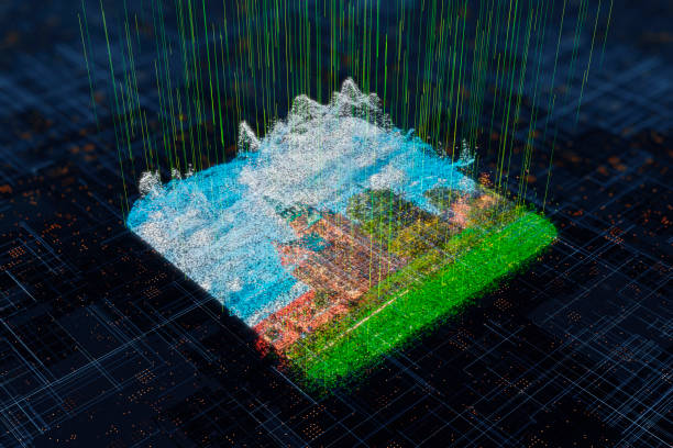
LiDAR, which stands for Light Detection and Ranging, is a remote sensing method that uses laser light to measure distances. In lidar remote sensing, laser pulses are emitted from an airborne or terrestrial sensor. These pulses reflect off surfaces and return to the sensor, which records the time taken for each pulse to return. This time delay is used to calculate precise distances, resulting in highly accurate 3D models of the terrain, vegetation, or structures.
Unlike traditional surveying methods, lidar remote sensing can generate millions of elevation points within a very short time, making it ideal for large-scale mapping projects. It also works efficiently in various environmental conditions, including dense forests and rugged terrains.
Applications of LiDAR Remote Sensing
One of the standout qualities of lidar remote sensing is its versatility across different industries. Below are some of the most prominent applications:
- Topographic Mapping
Surveyors and geospatial experts use lidar remote sensing to create detailed digital elevation models (DEMs) and digital terrain models (DTMs). These models are essential for infrastructure development, hydrological studies, and environmental assessments. - Forestry and Vegetation Analysis
Lidar is capable of penetrating tree canopies, providing data on both the forest floor and canopy structure. This feature makes it invaluable in estimating biomass, analyzing forest health, and planning sustainable logging operations. - Urban Planning and Smart Cities
Municipalities and urban planners leverage lidar remote sensing to map building heights, road networks, and public infrastructure. These data support better zoning decisions, urban growth projections, and emergency response planning. - Agriculture and Precision Farming
Farmers and agricultural scientists use lidar to analyze land surface elevations, which can impact irrigation, planting strategies, and soil health. Integrating this data leads to higher crop yields and resource optimization. - Disaster Management
In flood-prone areas or earthquake zones, lidar remote sensing helps in creating accurate hazard maps. Authorities can use these maps to prepare mitigation strategies and plan for emergency evacuations effectively.
Benefits of LiDAR Remote Sensing
Lidar remote sensing offers several advantages over conventional remote sensing techniques:
- High Accuracy: It provides elevation data with centimeter-level precision.
- Speed: Capable of collecting vast amounts of data quickly.
- Penetration Ability: Effective in capturing data under forest canopies and shallow water bodies.
- 3D Visualization: Produces high-resolution 3D models that are invaluable for visual analysis.
- Scalability: Suitable for both small-scale studies and large regional assessments.
Technological Advancements in LiDAR
Recent innovations in lidar remote sensing are making the technology even more accessible and effective. Miniaturized lidar sensors are now being mounted on drones, allowing for cost-effective surveys in remote or hard-to-reach locations. Additionally, advancements in machine learning and AI are enhancing the way lidar data is processed and interpreted, resulting in faster and more insightful outputs.
Challenges and Considerations
Despite its numerous benefits, lidar remote sensing comes with certain challenges. High initial costs, the need for specialized data processing skills, and large storage requirements for raw data can be barriers for some users. However, as technology matures and costs decrease, these challenges are becoming less significant.
The Future of LiDAR Remote Sensing
As the world continues to prioritize data-driven decision-making, lidar remote sensing will play an increasingly critical role. With its ability to deliver accurate, high-resolution, and real-time data, lidar is set to become a cornerstone of modern mapping, environmental monitoring, and infrastructure planning.
Emerging applications, such as autonomous vehicles and space exploration, are also incorporating lidar for navigation and terrain analysis. With such broad utility and continual improvements, lidar remote sensing is well-positioned to drive innovation in multiple sectors for years to come.
Conclusion
Lidar remote sensing represents a paradigm shift in how we perceive and analyze the physical world. Its ability to deliver precise and comprehensive data is unlocking new opportunities for innovation across industries. As technology advances and integration becomes more widespread, lidar will undoubtedly remain at the forefront of spatial analysis and remote sensing.