Screenshot
LiDAR technology has become a cornerstone for high-precision mapping and surveying, enabling professionals to capture detailed 3D data. However, to ensure this data is as accurate as possible, integrating LiDAR ground control targets is essential. These targets provide vital reference points that help align the point cloud data with real-world coordinates. In this article, we’ll explore how these targets improve LiDAR survey accuracy and share expert tips to achieve the best results.
What Are LiDAR Ground Control Targets?
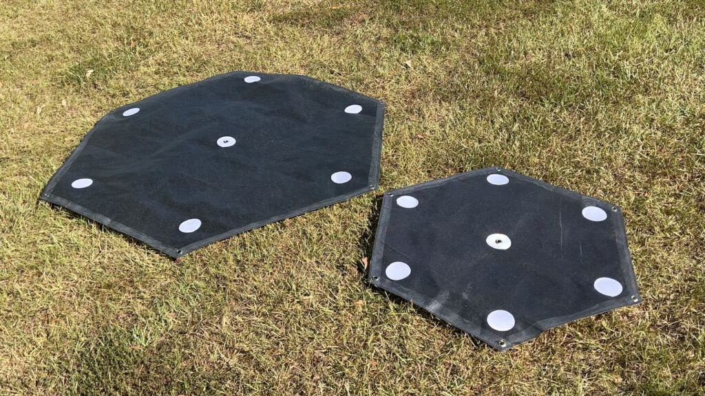
LiDAR ground control targets are markers placed at specific, known ground locations. These targets serve as reference points to improve georeferencing during post-processing of data. They allow surveyors to align and calibrate LiDAR point cloud data, which is critical for mapping applications that require high precision.
Without ground control targets, LiDAR data may not be fully aligned with real-world positions, leading to measurement inaccuracies that can affect the quality of final 3D models or maps. These targets play a key role in ensuring that LiDAR data aligns accurately with geographic coordinates.
Why Are LiDAR Ground Control Targets Important?
LiDAR surveys provide incredible levels of detail, but this detail is only useful if the data is accurate. Here’s why LiDAR ground control targets are essential:
- Enhanced Precision: Ground control targets enable precise calibration of the data, ensuring the final results are georeferenced to real-world coordinates.
- Minimizing Errors: They help correct any potential errors introduced by the sensor, such as misalignment or inaccuracies in point cloud data collection.
- Accurate Georeferencing: By providing known coordinates for the targets, these markers ensure that LiDAR data is aligned with the correct geographic locations, making it useful across industries such as construction, mining, and environmental monitoring.
Tips for Effectively Using LiDAR Ground Control Targets
To maximize the accuracy of your LiDAR survey, it’s essential to use ground control targets correctly. Here are expert tips for getting the most out of your survey.
1. Strategic Placement of Ground Control Targets
Proper placement of your control targets is vital for the success of the survey. Consider these points when positioning them:
- Distribute Evenly: Place targets at key locations across the survey area to avoid data distortion. Spread them out so that all parts of the area are covered.
- Ensure Visibility: Targets should be clearly visible to the LiDAR sensor. Avoid placing them behind obstacles or in areas with high vegetation that might obstruct the sensor’s line of sight.
- High-Contrast Targets: Choose brightly colored or reflective targets that stand out from the surrounding environment, improving their visibility in the LiDAR data.
2. Use High-Quality, Durable Targets
LiDAR ground control targets come in various designs, but quality matters:
- Reflective Materials: Use reflective markers to ensure they are easily visible in the LiDAR data, especially in diverse lighting conditions.
- Durability: Since these targets will be outdoors during the survey, ensure they are made from durable materials that can withstand various weather conditions.
- Size and Shape: Opt for large, easily recognizable shapes, such as checkerboards or crosses, that are clearly detectable by the LiDAR sensor.
3. Accurate GPS Measurements for Targets
The accuracy of the coordinates for your ground control targets is paramount. Using high-precision GPS systems, such as RTK (Real-Time Kinematic) GPS, ensures that the coordinates are as accurate as possible. This precision will ultimately make your LiDAR data more reliable when aligned with the control targets during post-processing.
4. Maintain Consistency in Data Collection
It’s not just about placing the targets; it’s also about how consistently you collect data:
- Multiple Targets: Incorporate several targets across your survey area to ensure the LiDAR data can be properly referenced in multiple locations.
- Field Verification: Always double-check the placement and coordinates of your targets in the field before starting data collection to avoid errors during post-processing.
5. Post-Processing: Aligning LiDAR Data with Ground Control Targets
Once you’ve collected your LiDAR data, the real work begins in post-processing. The integration of your control targets is crucial in this phase:
- Alignment: Use the control target coordinates to accurately align the LiDAR point cloud with real-world positions.
- Sensor Calibration: LiDAR sensors can experience slight misalignments during data collection. The use of control targets helps to adjust the data for these minor discrepancies, ensuring higher accuracy in the final product.
Conclusion
LiDAR ground control points are indispensable tools for enhancing the accuracy of LiDAR surveys. By ensuring that your data is properly aligned and georeferenced, these targets help to create more precise and reliable 3D models or maps. Following best practices for target placement, selection, and GPS measurement will ensure that your LiDAR data delivers the highest level of accuracy, making it a vital component for any high-precision mapping project.