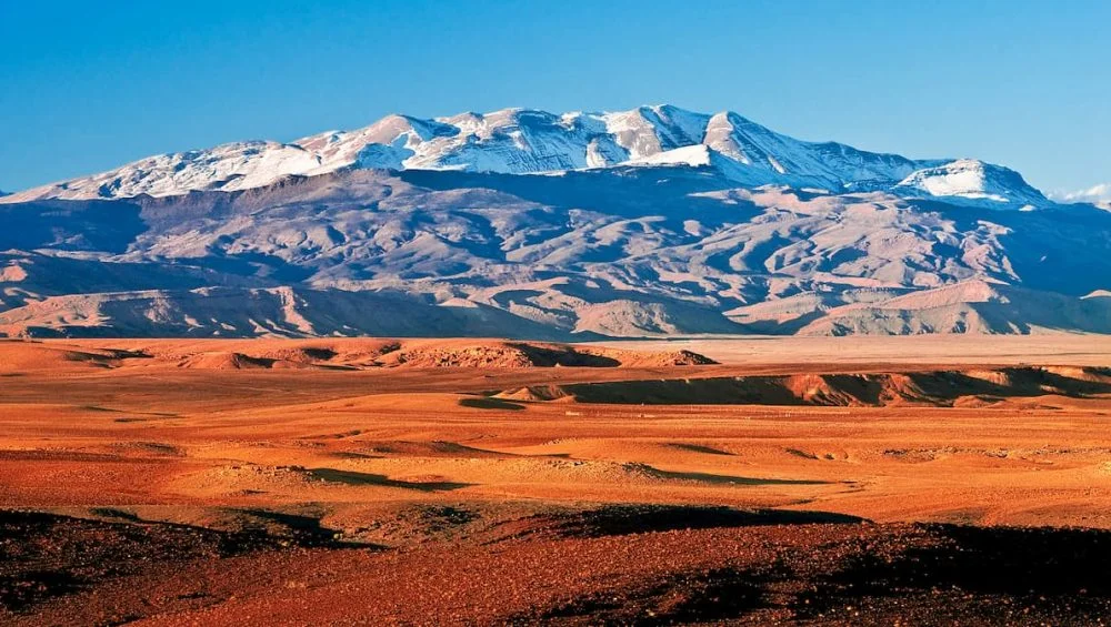
The Atlas Mountains are one of Africa’s most remarkable mountain systems, stretching across large parts of North Africa and creating a dramatic landscape of rugged peaks, valleys, plateaus, forests, and desert edges.
Understanding the geography of this region becomes much easier when you study a map of the Atlas Mountains in africa, particularly if you are planning a journey, researching geography, or simply want to understand how these mountains fit into the wider African landscape.
From Morocco to Tunisia, the Atlas range covers a considerable area and contains several distinct mountain sections. The mountains have also played an important role in shaping local climates, communities, agriculture, wildlife, and historical trade routes. This guide explains their location, major ranges, important peaks, surrounding regions, and what travelers should know when reading a map of the Atlas Mountains in africa.
Where Are the Atlas Mountains Located?
The Atlas Mountains are located in the northwestern part of Africa. They primarily extend through Morocco, Algeria, and Tunisia, although the most famous and dramatic sections are found in Morocco. The range generally runs from the southwestern part of Morocco toward the northeast, eventually reaching northern Algeria and Tunisia.
When examining a map of the atlas mountains in africa, you can see how the range separates different geographical environments. To the north are Mediterranean-influenced areas, while farther south the landscape transitions toward the Sahara Desert. This position gives the Atlas Mountains an important role in the region’s climate and water systems.
The mountains are not one continuous ridge with identical characteristics. Instead, they consist of several connected ranges, each with its own geography, elevation, vegetation, and cultural history.
The Major Atlas Mountain Ranges
The Atlas system is commonly divided into several major ranges. In Morocco, the three best-known sections are the High Atlas, Middle Atlas, and Anti-Atlas.
High Atlas
The High Atlas is the most spectacular section and contains the highest elevations in North Africa. It stretches across central Morocco and features deep valleys, rocky slopes, traditional villages, and snow-covered peaks during colder months.
Mount Toubkal, located within the High Atlas, reaches approximately 4,167 meters and is the highest mountain in Morocco and North Africa. The surrounding Toubkal National Park is especially popular with hikers and adventure travelers.
A detailed atlas mountains map can help identify the High Atlas in relation to Marrakech, Ouarzazate, and other important Moroccan destinations.
Middle Atlas
The Middle Atlas lies north of the High Atlas and has a somewhat different appearance. Its landscapes include forests, green valleys, volcanic formations, lakes, and high plateaus.
The region is particularly known for cedar forests, where Barbary macaques can be found. Towns such as Ifrane and Azrou provide convenient access to the surrounding mountain environment.
The Middle Atlas also plays an important role in Morocco’s water supply because several rivers and springs originate in or pass through this region.
Anti-Atlas
The Anti-Atlas is located farther south and is generally older and more geologically complex than some of the other Atlas ranges. Its terrain features dry valleys, rocky formations, and striking desert-like landscapes.
The Anti-Atlas is particularly interesting for travelers who want to explore less crowded areas. Places around Tafraoute are known for unusual rock formations, colorful landscapes, and traditional Berber communities.
The Atlas Mountains Beyond Morocco
Although Morocco contains the most recognizable parts of the range, the Atlas system continues eastward through Algeria and Tunisia. Algeria contains important sections of the Tell Atlas and Saharan Atlas, which form part of the broader mountain system.
Tunisia contains the eastern continuation of the Atlas region, although the mountains there are lower and less dramatic than the highest Moroccan peaks.
Looking at an atlas mountains map that includes all three countries provides a better understanding of how extensive the system really is. It also shows how the mountains interact with the Mediterranean coast, inland plateaus, and the Sahara.
Important Cities Near the Mountains
Several cities and towns serve as gateways to different parts of the Atlas Mountains. Marrakech is one of the most popular starting points for exploring the High Atlas. From Marrakech, travelers can reach mountain valleys and villages relatively easily.
Ouarzazate is another important destination on the southern side of the High Atlas. It provides access to landscapes that transition from mountains toward the Sahara.
In the Middle Atlas, Ifrane and Azrou are important centers for exploring forests and highland scenery. In the Anti-Atlas, Tafraoute offers access to distinctive mountain landscapes and traditional communities.
A map of the atlas mountains in africa makes it easier to understand the distances between these destinations and determine which mountain range is most convenient to visit.
Climate and Landscape
The Atlas Mountains have surprisingly varied climates because of differences in elevation and geographic position. Higher elevations can experience heavy snowfall during winter, while lower valleys may remain relatively mild.
The northern slopes generally receive more moisture than areas closer to the Sahara. As a result, forests and agricultural valleys can exist surprisingly close to dry, rocky landscapes.
Elevation is one of the most important factors affecting temperature. As you climb higher, temperatures generally become cooler, and the environment changes from cultivated valleys to forests, alpine terrain, and eventually bare rock.
This variation is one reason the Atlas region is so visually diverse. A single journey can take travelers through lush valleys, pine and cedar forests, high mountain passes, barren slopes, and semi-desert environments.
Rivers and Water Sources
The Atlas Mountains are extremely important to North Africa’s water resources. Snow and rainfall collected in higher elevations feed rivers and underground water systems that support communities and agriculture.
Many valleys contain fertile areas where farmers grow fruits, vegetables, olives, and other crops. Traditional irrigation systems have allowed communities to cultivate land even in relatively dry environments.
The mountains therefore function as natural water towers for surrounding regions. Understanding their location on a map of the atlas mountains in africa also helps explain why major settlements and agricultural areas developed around particular valleys and river systems.
Wildlife and Natural Environment
The Atlas Mountains support a wide variety of plants and animals. Depending on the elevation and location, visitors may encounter cedar forests, juniper trees, alpine plants, and dryland vegetation.
Barbary macaques are among the best-known animals associated with the region. Birds of prey, foxes, wild boar, and other wildlife also inhabit different parts of the mountain system.
Protected areas and national parks have helped preserve important habitats. However, environmental pressures such as water shortages, climate change, deforestation, and increased development continue to affect some areas.
Why Maps Are Important for Travelers
A good map is more than a way to identify mountain peaks. It can help travelers understand roads, mountain passes, villages, hiking routes, national parks, valleys, and distances between destinations.
The Atlas Mountains map is especially useful when planning a route because mountain roads can take considerably longer than straight-line distances suggest. Weather conditions, road quality, elevation, and seasonal closures may also affect travel.
Hikers should pay particular attention to elevation and trail locations. High-altitude routes require suitable preparation, especially during winter or changing weather conditions.
Best Time to Explore the Atlas Mountains
The ideal season depends on what you want to experience. Spring and autumn are generally comfortable for hiking and sightseeing in many areas. Summer can be hot in lower valleys but remains cooler at higher elevations.
Winter brings snow to high mountain areas, making it attractive for snow-related activities but potentially more challenging for hiking and driving.
Before traveling, visitors should check local weather and road conditions, particularly when crossing high passes.
Final Thoughts
The Atlas Mountains are far more than a single mountain chain. They are a complex geographical system extending across Morocco, Algeria, and Tunisia, with different ranges, climates, ecosystems, and cultural landscapes.
Studying a map of the Atlas Mountains in africa provides a valuable starting point for understanding this remarkable region. Whether your interest is geography, hiking, history, wildlife, or travel, the map helps connect the major ranges and surrounding destinations.
With its towering High Atlas peaks, forested Middle Atlas landscapes, ancient Anti-Atlas formations, and eastern extensions into Algeria and Tunisia, the Atlas system offers an extraordinary combination of natural beauty and cultural heritage. Using an accurate Atlas Mountains map alongside reliable travel information can make exploring this fascinating part of Africa much easier and more rewarding.